Wolverine Hikes

People who know me know that I belong on the Trail. I've thru-hiked the Appalachian Trail (three times, now),the Pacific Crest Trail and the mighty Continental Divide Trail. I've hiked many of the long trails here in Michigan including being the first to hike both the Ironwood Trail and the Great Lake To Lake Trail. In 2017, I hiked the Israel National Trail and the Golan Heights Trail. I was the first to hike the Baja Divide Trail in Mexico but failed miserably to thru-hike the Bruce Trail in Canada. In 2019, I hiked the TEMBR in Ecuador and 1,150 miles of the North Country Trail as it runs through my home state of Michigan.

The purpose of this blog is to keep anyone who is interested informed of my progress and to encourage those who are able to support me in these endeavors.

Thursday, June 12, 2014

The Real CDT


The motto of the CDT is "Embrace the Brutality". About 8 miles south of the Colorado border, I saw the brutality. I did not embrace it. I ran and hid in my tent like a little girl. Beaker and I were up at about 10K feet when hail turned to rain turned to sleet and that, finally, turned to snow. We couldn't find the trail. Our paper maps were shredding in the wind and rain like tissues. Phones and GPS couldn't find us and we could barely read the screens, anyway. It was brutal. We set up our tents and hid, shivering inside.

Connecting with the trail north of Creede, Colorado was an experience. As I made my way up to the 12,300 foot San Luis Pass, I couldn't wait to see what was on the other side. I finally made it over to find that Colorado didn't know that it was June. Still, tons of snow up there. I began fighting my way through this obstacle course for long distance hikers. There were long stretches of post holing in deep snow. There were some steep shale scrambles to climb, there were raging rivers to ford... THIS was the CDT I had been looking for. It was brutal. And I was embracing it.

The trouble with this kind of hiking is that it takes forever. That means carrying more food. That means needing more battery power. You start early in the morning so you can walk on top of the frozen crust over the snow fields. By early afternoon, you're worried about falling through the snow to the river running... right under you! You have to pause constantly to look at the terrain, look at your map, try and figure out a way around, a way through... I became convinced that there was only one way, a small thread that, if I found it, I could make it through. I passed a series of 'no turning back' type features like glissading 300 feet down the side of a mountain. It was fun doing it but, when I looked back up that hill, I knew there was no way I could go back up it. We try not to do this in long distance hiking. Climbers call it getting 'cliffed off'. Passing obstacles that make it impossible to get back the way you came from is not always the best move but, on the other hand, you have to commit at some point. You have to say, "I'm not going back and I will find a way around any obstacles before me."

I used every bit of gear that I brought. My ice axe, while heavy, saved my butt several times. The Yak Trax on my boots gave me just enough traction to climb up steep snow and the gators kept my feet dry. I ended up being very glad that I carried all of it. Having said that, I think it's time to send it all home. My pack is way too heavy and I don't think I'll need those things from here on out.

I finally came down out of the mountains to the lush Cochetopa Valley. Back to the kind of hiking I really enjoy - big miles, beautiful scenery  and plenty of water. According to the map, I needed to cross this river. Both a bridge and a beaver dam that used to cross this river were out but I was brimming with confidence, having just forded a dozen rivers of equal intensity. I took all the usual precautions: I took off my boots, socks and gators and tied them to my pack. I unbuckled all the straps on my pack. I checked my phone one last time before crossing to make sure I was on the right track. Tucked the phone into the GoreTex pocket of my shell (see the mistake?). I picked a 'bail out' point downstream - something to aim for if a fell in. As I inched closer to the fast water, my trekking pole vibrated wildly in the rushing water. This was deeper and faster than I had anticipated. Right when I decided to go back and give this some more thought, the 'shelf' of pebbles I was standing on gave way and in I went. I swam for the far shore. One of my trekking poles lodged under water and pulled my shoulder down with it, trapping my arm. I had to get my wrist out of the strap and kiss that pole goodbye before I could climb out onto shore, soaked to the bone. Suddenly, a wave of panic engulfed me. My phone! Did that pocket keep it dry? Nope. It was soaked. As quickly as I could, I wiped it off, wrapped it in a bandana and stuck it in a bag of rice. I had heard that sometimes the rice can draw the moisture out and save the phone. I left it in there for full two days. No luck. Getting a new phone on the trail is a HUGE pain. My only hope is that my trusty Resupply Coordinator can replace it.

Having hiked for a while now without a phone, I see that I was way too dependent upon it. Yes, my phone is my only source for communicating with the outside world and I wouldn't hike without one if I could avoid it but I had no choice. I felt terrible about all the pictures and video that were lost. I had a silver fox come within 10 feet of me and I got it all on video (!) but now it's all gone. That's okay, I have the memory forever. I needed to rid myself of the feeling of needing an outlet and going out of my way to charge the phone. I needed to rid myself of the addiction to email and social media and going off trail just to find a WiFi source. I needed to trust my navigation with paper maps and compass more. I had been using map and compass and just using Guthook's app to confirm my location but not having a phone to check makes you trust your compass. Maybe ruining my phone was the Trail's way of teaching me that I don't need it and to stop depending on it so much. Lesson learned. Just the same, I contacted Super Resupply Coordinator Martha Rogers and she is sending me a new one. I will reload Guthook's app and continue the hike.

 Also lost were great pics of my Honor Point backpack, Astro's bandanna, me keeping warm in my Stormy Kromer, etc... Luckily, there's lots more trail to hike and many more pictures to take. Stay tuned for more, soon!

Saturday, May 31, 2014

Finding A Way

The deep snow we all encountered south of the Colorado border made everyone revise their plans. Snow makes everything more difficult. This is old, nasty snow from last winter. It's icy and wet with a thin crust on top - you have to 'post hole' your way through it (see the video I posted to Facebook) and you fall through up to your waist when you least expect it. Snow obscures blazes, rock cairns and the trail itself. Navigation becomes even more difficult. You have to carry more food,
more gear... 

My buddy Beaker and some others rented a van and are going to pick up the trail north of here, then come back later to finish this section. Same for my brothers from Warrior Hike - they're flipping out of Pagosa Springs. Some hikers are just going to wait a while until more of the snow melts. Me? I've got to keep moving north. Even if I have to take lower elevation routes or road walk. I HAVE to WALK from Mexico to Canada. So many people are helping me with this hike - I can't let them down. Gotta find a way...

Resupply has been working like a fine oiled machine. Generous folks have been contributing food and gear (thanks for the snow shoes, Burning Boots Trail Club!) and Martha has been getting it to me on the trail. Like Stafford handing off to Bush for a huge gain, I can sprint by the post office and grab my resupply box in stride. Huge thanks to Camp Champaign. 

Shipping boxes is eating away at the budget. If you want to help me with this hike, please click on the 'donate' button. Every bit is appreciated. 


This is a good outline of the entire trail. 


Me at Wolf Creek Pass. Dark clouds loom in the distance. 

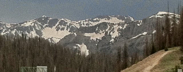
Gotta find a way over those mountains!


Getting a big box of love at the post office. Thanks, everyone!

Hiker trash in Cuba, NM. From the left: the Viking, me, Beaker, Samurai, NO2, Doc Rocket and Buffalo Shuffle.


HillierHikes.com

Monday, May 19, 2014

Big Miles, No Water

Beaker and I knocked out this last 106 miles in a little over 4 days. The trail has been well marked and really beautiful. We are both feeling pretty good so the miles came easy. The hard part was the lack of water. This part of New Mexico is suffering from a 10 year drought. Places on the map that promised a water source were bone dry. You can't imagine the disappointment in hiking all day without water only to find a spring that dried up long ago. 

We've hiked on and off with some of the Warrior Hike guys as well as some section hikers but usually, we're the only people out there. I'm glad for Beaker's company. He's an experienced hiker and he's better at navigation than I am. I hiked with him and his wife on the AT and they angel'ed me on the PCT. Good people. 

My Honor Point pack continues to kick ass and my Stormy Kromer keeps me warm even when my water is frozen.  Please leave a comment below and stay tuned for more gear updates. 
The tiny green speck at about 9 o'clock is Beaker. There are a dozen radio towers on the mountain ahead but I still can't get cell reception. 


I love that warm, early morning sunshine. 

This guy was blocking the trail. Not sure what species.

Beaker and our new friend. 

Looking out over the desert. 

HillierHikes.com

Thursday, May 8, 2014

Life on the Trail

As I open my eyes early in the morning, I can see that it's just starting to get light. I can hear birds chirping in the distance. What a wonderful way to wake OH MY GOD MY FEET HURT. Still lots of blisters and swelling. And it's freezing outside. Literally, freezing... My water bottles are frozen and SO ARE MY SHOES. While I'm glad to be on the trail, I do not look forward to fording the freezing waters of the Gila River another thousand times today. 

Yes, it's a cold morning and my feet hurt but there is no where else I'd rather be. This is the middle fork of the Gila River. The land of the Warm Springs Apache - the Burning Eye People. Geronimo was born here and his birth place is a sacred thing to the Chiricahua. I don't think they like us being here. I can feel the spirits of Apache warriors looking down from the high cliff walls. 

At this point, we're still 3 or 4 days out from our next stop: Pie Town, NM. We'll pick up our resupply boxes and rest up a bit. I can't wait to get there. I need the rest. My body is pretty beat up. This trail is much more difficult than either the Pacific Crest Trail or the Appalachian Trail. Navigation continues to be a challenge.  Water sources are still very far apart and a couple of times, they have been bone dry when we finally found them. 

Over the next couple of weeks, I'll pass through Grants, NM and Cuba, NM on my way up into the south San Juan Mountains of Colorado. That will be a whole different set of challenges: snow, altitude, heavy gear and a barely defined trail. 

I'm so grateful to everyone who has helped me get to this point: Lynnae and Will in Mimbres, Nita at the Toaster House in Pie Town, the men from the Forest Service who work the fire lookout towers: Phil, John and Dave. And, of course, all my friends at Honor Point, Running Fit, Moosejaw, Fitbit, Stormy Kromer and the Burning Boots Trail Club. 

Please leave a comment and stay tuned for more soon...


Hydration is so important. I need about one liter for every 5 miles I hike. 

I think of my friend Astro every step of the way. 


Made it to Pie Town. 120 miles in 5 1/2 days. 

Nita has helped hundreds of hikers over the years. 
HillierHikes.com

Thursday, May 1, 2014

Update 5/1/2014


Happy Thursday!  I thought I'd give an update on Chris/Wolverine. He's hiked about 200 miles so far and sounds great.  He says his "spirits are soaring!"  Which is fantastic to hear
He will walk into Pie Town New Mexico in about 6 days.  Check this place out: http://www.pietown.com
His stop after that is Ghost Ranch near the New Mexico/Colorado border.  This is where I will send his winter gear, for the Rocky Mountains, things like an ice ax, crampons (these hook to the bottom of your shoe and have small spikes on them to help you walk on ice, heavy boots, warm socks, and his stove so he can have hot meals.

Have you seen the video on how to get water on the CDT?  Take a look.
https://www.facebook.com/photo.php?v=451330071664231&l=5839163658972826169


If anyone out there would like to send him a message or anything else, let me know and I will get it to him.
Thank you all for your support.  Keep those positive thought, good vibes and love coming for our hiker!


Monday, April 28, 2014

Update from Chris 4/27/2014

Hello all, Martha here:

I talked to Chris on Sunday the 27th and all was well.  He and Gary and Beaker ( Bob Turner) had stopped in Mimbres to take a well eared zero.  Everyone was tired, a bit sore and just needed to relax.  Gary has taken some great photos.  Are you following his blog, Our Endless Earth too?

Chris started hiking again Monday, 4/28 and will hit Pie Town (!) then Grants and Cuba.  the stop after that is Ghost Ranch where I will be sending all his winter type gear, ice ice, crampons, gloves, lined pants, stove and more.

I'm sure you have read of Chris dedicating his hike to Andy-Astro.  Read here for a post from Andy's Mom, Elizabeth Gosselin http://hikingthepacificcrest.wordpress.com

I'll continue to update here when Chris doesn't have time or connectivity.  Feel free to join me on my Facebook page,  https://www.facebook.com

Some very nice and generous donations have been coming in.
A HUGE thanks to everyone out there.

This is what a zero day looks like:


Saturday, April 19, 2014

And They're Off!

I'm finally home, where I belong. Back on the trail. 


After two hellish days and nights on a Greyhound bus, Gary and I finally met up with Beaker and made it to Deming, NM. Trail Angels Keith and Mary Schwarzer helped us with local info and made sure we made it down to Palomas, Mexico. We ate a huge meal while a Mariachi band played. Getting back across the border was no problem and the hike had begun. Didn't get started until about 2pm and did a straight road walk about 12 miles north right back to Willie Pritchard's ranch. He kindly let us camp and water up on his property.


First full day on the trail was a blunt reminder of how harsh this environment can be. Every plant wants to stab you - each of us had 1 1/2" thorns poke through the soles of our trail shoes and into our feet. The sun is intense and there is absolutely no shade to be found. Sand and wind that can blast a license plate clean. Carrying enough water to get to the next source and navigation are the main concerns. Made 23 miles today and set up our tents in 30mph winds. 


Stay tuned for posts about the prototype backpack that Honor Point made for me, using Fitbit to track my mileage, staying warm with Stormy Kromer and my Montrail shoes from Ann Arbor's Running Fit. 


Gary and Beaker mark the GPS location of a water cache in the middle of the desert. 
Trail Angel Keith Schwarzer.

Gary and Chris hold the CDT bandana in front of the Pancho Villa statue in Palomas, Mexico.

Chicken mole and a Mariachi band to celebrate the start of the hike.

Mostly road walking the first day.