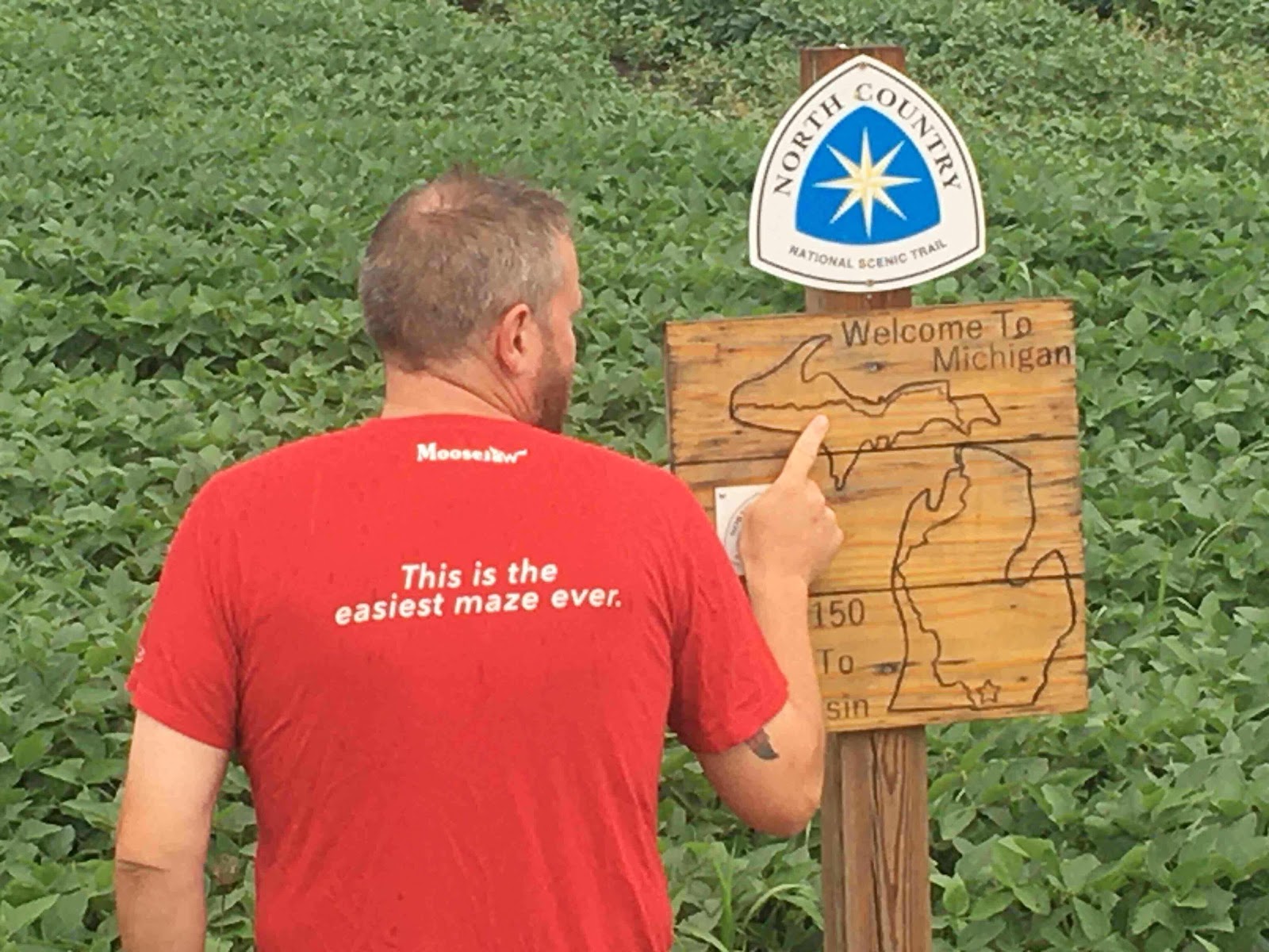
Can you see what it says on my shirt as I’m pointing to a map of the trail? Turned out to be darkly prophetic.
A guy walks into a bar carrying a giant backpack and smelling like the Devil himself. Server hands him a menu and says, “Everybody got a story to tell. You look like you got a good one.”
I’ve got a story, alright, about a sojourn of the North Country Trail as it runs through Michigan. 1,150 glorious miles from tiny Waldron, MI (at the border with Ohio) to the City of Ironwood at the far western end of the UP.
The hike started off well enough: My friend Sandy got me to the trail and sent me on my way in a light rain. Almost immediately, that feeling of being back on the trail - of being ‘home’, swept over me and I really enjoyed the whole first week. I happened upon little towns about every other day so resupply was easy and I was making a special effort to visit as many Michigan Craft Breweries as possible (I’m a big fan). In fact, the whole theme of this hike was ‘How far would Wolverine walk to sample a Cold Iron beer?’ referring, of course, to Cold Iron Brewing in Ironwood.
Somewhere around weeks two and three, I started feeling some serious bilateral foot and ankle pain. There was serious swelling and even some deep bruising that I found disconcerting. This was beyond the usual aches and pains I’d experienced when getting my ‘trail legs’ back under me. At one point, after a failed attempt to hitch into a town, I gimped pathetically along the side of the road, looking much more like a broken down homeless man than Wolverine, Triple Crown Hiker.
But then I kept hiking and it went away. As does all my pain and woe, eventually.
Part of my miraculous recovery had to do with spending a full Zero Day (zero miles hiked!) in town with my girlfriend (the lovely Jackie Papineau). After resting, hydrating and stretching, I returned to the trail feeling 100% better. This is when things got really good: I felt great, temps were perfect for hiking and the trail was flat. I started stringing together 20+ mile days with no problems. I also started ‘Platinum Blazing’ (as we Hikers call it): Spending a night in a comfy hotel with Jackie every couple weeks and eating at fancy restaurants every chance I got! Life couldn’t get any better!
But then it got better. I had made it to the Mackinac Bridge way ahead of schedule. Jackie met me there, as well as fellow long distance hiker Brian ‘Buck 30’ Tanzman. This was a big deal for me as he is a way more experienced hiker than I and this was my chance to learn from him. And oh, did I learn. More on that, later.
I started hiking the 550 miles across the Upper Peninsula like a pro. The miles flew by. The highlight of the whole hike (perhaps of my whole life!) was hiking Pictured Rocks with Jackie. We spent almost a whole week together including a full zero in Grand Marais. It was fantastic.
At this point, it was ‘all systems go’. I had just under a month to hike the last 250 miles or so. True, it was getting colder out but my gear was solid and I felt unstoppable. I couldn’t wait to see everybody at the end! My calendar for the last week on the trail filled up quickly with dates for doing trail maintenance, meeting up and hiking with Moosejaw peeps and plans for the ‘big finish’ in Ironwood.
And then it all went wrong.
Leaving out of tiny L’Anse, Michigan, I was good-to-go. I had a few miles of road-walking to get back to the trail and somewhere along there, I LOST MY PHONE. I walked up and down the mile of highway where I was sure it had fallen out of my jacket SIX TIMES to no avail. The phone was gone.
A word about modern long distance hikers and smart phones: We love them. They are our (primary) form of navigation (see my previous post about cell phone apps for hiking) and they are how we communicate and coordinate things like dates and locations for meeting people on the trail. Not to mention our cameras, our music and our written and recorded thoughts. Now, I always say not to rely solely on your phone and to carry a paper map and a compass, just in case, and I do. Not a very detailed map, mind you, but enough to get me out of a jam.
I was in a jam. Without that damn phone, I would only have the blue blazes that mark the North Country Trail. It would be risky and I would never know where I was at. Plus, if I didn’t show up with the people I was supposed to meet and didn’t let folks at home know I was okay, it would trigger a call for Search and Rescue. If I had printed and carried more detailed maps, I could have continued but still not been able to contact people.
I began to panic. Was this hike over for me? After all, this was supposed to be my ‘fall back hike’. An easy thousand miles that I could do if other plans didn’t work out. Now, here I was, freezing in the snow, asking a DNR guy at a campground if I could borrow his phone to call my brother.
My brother Rob is an Information Systems Administrator but his real job is getting me out of trouble. He’s been doing it for 52 years, now. He told me to stay put for the night and he would be there the next day. That had to be one of the worst nights in my hiking career. Buried in my tent, huge snow flakes falling all around me and tears streaming down my face. I had let everybody down. I would never make it to Ironwood.
Rob and I talked about all the options during the long drive home. I crashed at his house for a couple days to dry out and gear up. The priority had to be to contact the people I was supposed to meet on the trail and cancel. Then, figure out a way to salvage this hike. Rob insisted that I get another phone before going back up there. Fortunately, I was able to pick up a used iPhone for $170 and Jackie helped me go over all my gear, making sure that I had what I needed to make it to Ironwood. I would ditch my stove and cooking pot and just eat cold. I added a $30 Frog Toggs rainsuit (good call, Rob) and an extra pair of socks.
We decided that, because of the conditions (the weather, my shaken confidence and my desire to finish by Halloween), I would just road-walk it into Ironwood. Not the way I had pictured ending the hike but at least I will have finished. Rob drove me all the way back up to the UP and dropped me about 85 miles away from Ironwood.
As I walked along the highway in the heavy snow, I thought back on my long history of relying too much on my cell phone: During the AT ‘11, I plugged my phone into a bad outlet and killed it. My sister Patti had to mail me a new one on the trail. On the CDT ‘14, I fell into a river and drowned my phone. My friend Martha was able to send me a new one. On the AT ‘15, I left my phone in the truck of a guy who gave me a ride to the trail. He was kind enough to leave it with the Sheriff’s office and it was returned to me. On the very first day of the Israel National Trail, my phone died (again, bad socket) but resurrected itself 12 hours later, Lazarus-style. Then, of course, my phone was pick-pocketed in a crowded bus station in Ecuador in ‘19. And now, I let my phone fall out of my jacket and the punishment for making the same mistake (over and over, apparently) is a long road-walk into Ironwood. This horrible task is a penance that must be served. Snow and sleet all day that freezes solid overnight. Double-trailer logging trucks blasting past just a couple feet away, spraying dirty slush on guilty hikers. No one offers a ride as there are no angels here on Purgatory’s Trail. I was feelin’ pretty low.
And then it got worse. Temps dropped. The snow got deeper. I ran out of food. My water filter froze so I had to drink foamy brown river water. Road-walking into Ironwood in late October was the worst idea ever.
I pushed forward into the little town of Marinesco, home of Two Fat Guys Bar and Grill. Not only did they serve up a giant bacon cheeseburger but they GAVE (they would not accept payment) me enough food to make it to the next town! My heart swelled with gratitude. Maybe I would make it, after all.
Getting back to what I learned from Buck 30: Don’t make the hike more complicated than it needs to be. Brian rarely agrees to meet up with people on the trail. He’s not beholden to any sponsors. He doesn’t even take advantage of the hospitality that Trail Angels sometimes offer - he’d rather just get a hotel room and then keep moving at his own pace and without deadlines and appointments.
TL/DR: I lost my phone and had to road-walk into Ironwood.
Got a question or comment? Have any advice? Ideas on what I could have done differently? Click below and start typing!