Wolverine Hikes

People who know me know that I belong on the Trail. I've thru-hiked the Appalachian Trail (three times, now),the Pacific Crest Trail and the mighty Continental Divide Trail. I've hiked many of the long trails here in Michigan including being the first to hike both the Ironwood Trail and the Great Lake To Lake Trail. In 2017, I hiked the Israel National Trail and the Golan Heights Trail. I was the first to hike the Baja Divide Trail in Mexico but failed miserably to thru-hike the Bruce Trail in Canada. In 2019, I hiked the TEMBR in Ecuador and 1,150 miles of the North Country Trail as it runs through my home state of Michigan.

The purpose of this blog is to keep anyone who is interested informed of my progress and to encourage those who are able to support me in these endeavors.

Tuesday, September 28, 2021

Good Gear Bad Gear


Not all hikers like talking about gear. In fact, none of the hikers whom I really admire, talk much about their gear - they can make pretty much make anything work for them. But I DO like to talk about gear.


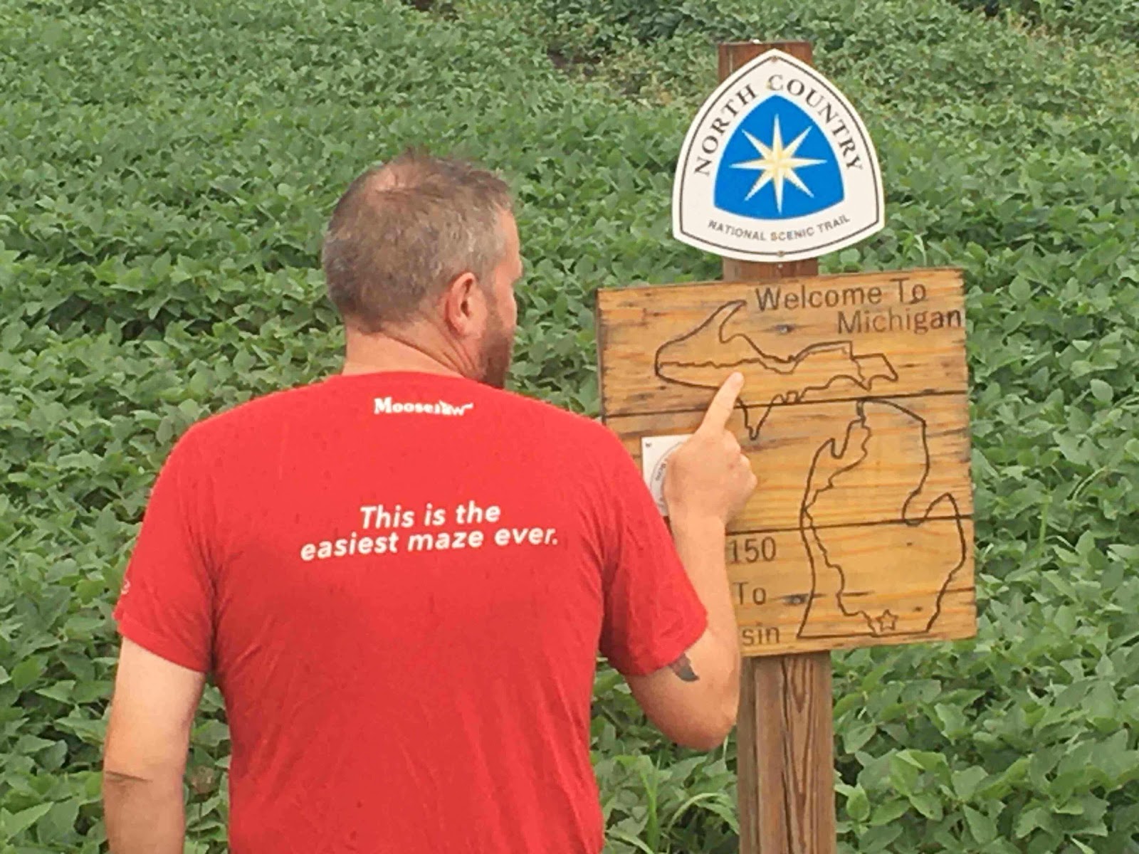
I lifted this from Jeff McWilliams FB page.


The Bad
I've only had one major gear failure out here, so I'll get it out of the way first: My Big Agnes Fly Creek tent. I've been through five of these tents since I first borrowed (stole?) a Fly Creek Platinum from Jason 'Hee Haw' Phelps in 2015. They are a solid, free-standing tent that comes with a rainfly. Wildly popular on the Appalachian Trail this year, I have seen dozens of them. They WERE my go to tent until the company that makes their tent poles - DAC - started cutting corners. I've had three sets of poles break in the same place. Two other hikers have told me the same story. Getting stuck on the AT with no tent kinda sucks. Customer Service at Big Agnes tries hard but I'm done with them. Big Agnes = Big Headache.

Good Gear
Osprey backpacks. I'm currently carrying a 60L Levity pack and I love it.


I've also had good luck with the Osprey Aether pack. Again, I'm seeing lots of these same packs on the AT this year and the owners seem to be satisfied. Mine already had 1,200 miles on it before I hiked the last 2,075 (as of this writing) and it's still going strong. My last one also lasted thousands of miles before the buckle on the waist belt broke. That was no fun.

My trusty Salomon Speedcross shoes.


Trail after trail - Israel, Mexico, Ecuador... This is my fave three-season footwear. I take them out of the box and wear them until they disintegrate, pair after pair. They're like slippers with cleats!

Black Diamond trekking poles.


My current set (I've gone through many) also had 1,200 miles on them before I started this hike and they are hanging tough. Not all of their models were great - the 'Z-Fold' models held together with a shock cord both broke on me in Michigan's Upper Peninsula but the Trail Pro sticks I have now are awesome. Their headlamps? Well, I have owned four of them. Sometimes they work, sometimes they don't.

My bulletproof Marmot shell.


The first of these (I'm on my third) was a gift from Traci Rink on the PCT '12. I've worn them ever since.

 Icebreaker shirts! Traci Rink (again!) turned me on to these Marino wool shirts and I loved them. My first friend ever at Moosejaw, Perry Keydel, sent me a bunch of Icebreaker shirts for this hike. Even as bad as I stink - they don't.


 Darn Tough socks. Early on, I was a Smart Wool kinda-guy. Later, I was a fan of the plain, nylon sock for a long time - Ray Jardine style. Nylon dress socks wear out quick but they're cheap and they dry quickly. I had seen lots of Darn Tough socks on the trail but $30 a pair seemed excessive. But what if they lasted for hundreds of miles? And provided some compression? Darn Tough, IMHO, are worth it.


 The Tent LabsDeuce #2 trowel.


You gotta dig a hole 4"-6" deep every morning. Thank Goodness for this lightweight, indestructible tool.

I saved the best gear for last: Underground Quilts! I went to them in 2016 to make an ultralight quilt for me for the Baja Divide Trail and I've been with them ever since. The Bandit quilt they made for me lasted for almost 5K miles!


 I'll be carrying my new Bandit Quilt this spring.


Honorable Mentions
Stormy Kromer doesn't make hiking gear, but the classic hat they make has kept me warm (and looking cool) even in the worst conditions.


 Mountain Hardware puffy. The zipper broke pretty early on (see my fancy sewing?). Yet, I still carry it because it keeps me warm.


Columbia clothing. I buy convertible pants and a long-sleeved PFG shirt for every hike. Why? Bugs and sun. Many hikers prance past me wearing only running shorts and a tank top asking, "Wolverine, why the long pants and sleeves?" "Bugs and sun." I tell them, "Bugs and sun... "

I've also carried a piece of  Tyvek as a ground cloth on every hike. My sister, Carol, even sewed a big piece into a bivy for me on the PCT '12.

Please note,I didn't include the hyperlinks in this post because I'm an 'affiliate marketer'. They're just so you can see the product. If you see something you like, go buy it at Moosejaw.com 

I'm also a big fan of Treeline Review for articles and aggregate gear reviews.

Or, just contact me! I'll talk about gear and hiking all day!

Disclaimer: Every single piece of gear I mention above was either begged, borrowed or stolen. I take what I can get to keep me on the trail and I'm grateful for every bit of it.
Got a fave piece of gear? Leave a comment below!


Monday, September 20, 2021

The Lost Art of Hitchhiking

I have lots to say about this topic, but first, a gentle reminder: Resupply here in super-remote central Maine is rare and very expensive.


Some hikers were complaining that this is 'gouging' but it's what the market will bare.


I'm so close to finishing my third thru of the AT; I just need a little bit more help. I'll make you a deal: If you hit that 'donate' button, I'll PM you with details about my Top Secret (and controversial?) plans for hiking this spring!

Now for the obvious yet obligatory disclaimers: Hitchhiking is inherently dangerous and often illegal. You should not do it. Nor should you pick up hitchhikers. And yet, hitchhiking is part of almost every long distance hike. If you're going to attempt a hike of more than say, five hundred miles, eventually, you're going to need to get off the trail and get to a town for supplies. If the town is close enough, you might be able to walk there. Otherwise, stick out your thumb and hope for the best.

Having noted that hitchhiking could be dangerous, it's a little different when you're hitching close to a well-known trail. People see the big backpack and they know what you're up to. So location makes a big difference. If you see a guy like me trying to hitch in Downriver Detroit, think twice about letting him in your car. If you see a guy like me carrying a giant backpack near the Appalachian Trail, chances are that I'm just trying to get to town - or back to the trail.

With a little planning and a lot of luck, you can get to your destination and possibly meet some really cool people along the way. Here are some hints for a safe and successful hitch:

- Make sure you make your intentions clear: Stick out your thumb and smile. It helps to have a 'Hiker to Town' or a 'Hiker to Trail' sign. I have a bandana with that on it (thanks, Christina Ray!). Or write your destination on a piece of cardboard - or on your folded-up ground cloth, like I do. People are more likely to give you a ride if they know where you're going.


 - Stand well off the road and make sure that any car that slows for you has plenty of room to safely pull over. Don't hitch on a curve or the crest of a hill. Pick a spot where people have a chance to see you to see what you're doing. Sometimes, I walk in the direction of the town/trail and I only stick out my thumb when it is safe to do so. I think people are more likely to give you a lift if they see that you are trying, at least, to get your destination

- Never be negative towards drivers that don't pull over. Occasionally, people have passed me by but picked me up on their return trip. No one is going to do that if you gave them the finger for not pulling over the first time by. Be positive... Smile... Let them see your face and wave back to people who wave at you.

- Be prepared to offer some gas money. I keep a few singles in my pocket, separate from my main stash in my wallet, just for this purpose.

- When someone pulls over, hurry (run!) to their car; Don't waste their time. Have your pack in order and ready to throw in a trunk or the bed of a truck. Have your phone out and a map of where you're trying to get to.

- I always approach the passenger side of the vehicle and wait for a window to come down or the door to open. BEFORE you get in, thank the person for pulling over. Make sure you both agree on where you are trying to get to and how close they can get you. I also warn drivers if I am particularly stinky, wet or muddy. You don't want to mess up their nice car!

- Most people who give rides to hikers are like-minded people. I often see trekking poles or hiking boots in their cars. Sometimes, they're just curious about who you are and what you're doing. And sometimes, they're flat-out crazy. Be prepared for political or religious rants, off-the-wall questions and bad music. Sometimes, people are just looking for some company and, in exchange for a ride, it's the least you can provide.

- Have an excuse to stop the car and get out. For example, if I ever got a really bad vibe from someone, I would say, "I just remembered that my buddy has my wallet! I was supposed to wait for him at the trailhead. I have to walk back there." This tells the driver that a)You have no money and b) Someone is looking for you. That should be enough to convince them to pull over and let you out. I've never had to use this.

- Finally, when you get to your destination, thank the driver appropriately, offer the gas money and ALWAYS double check that you have all your gear: Trekking poles, phone, wallet... I forgot my phone in a guy's truck one time. Read that story here.

People often seem to feel good about themselves for having helped you and they should! They feel good and you are grateful for the ride - let it be a positive situation! I sometimes say something like, "I hope someone does something nice for you like you did for me."

I have met some of the nicest people through hitchhiking. I've had people open their homes to me and invite me to stay. I've met people with whom I've stayed in touch with for years. And I've had some pretty memorable characters that made for a great story later on.

Obviously, I can't add the female perspective. The best I can do is refer you back to the guest blog post by Brazil's own Denise Stolnik. You can read that post here.

Got a great hitchhiking story? Leave a comment below!

Do you know me because you gave me a ride in the past? Leave a comment below!

Do you completely disagree with me and wish I wouldn't encourage people to hitch? Leave me a comment below!

Wanna know what my super-secret plans are for this spring? Hit that 'donation' button!

Thank you!


Friday, September 10, 2021

No More Work-For-Stay?


The Lakes of the Clouds hut.

This is 'The Dungeon'. It's an emergency shelter that hikers can stay in for $10. I stayed in there in '11. It was creepy and weird.

During both my previous thru-hikes of the Appalachian Trail ('11 and '15), I was fortunate enough to trade work for a night indoors and I was glad for it. The 'huts' are kind of like a primitive hotel: For $150, you get a bunk, breakfast and dinner. There are no frills and you have to  pack out your own trash. Lots of day hikers and section hikers gladly pay the cash for access to the beautiful White Mountains. 

Zoom in to see the Madison Springs hut.

My first time thru the AT, fellow hiker Sabine 'Foureyes' Pelton, told me about WFS (work-for-stay) at the huts. If you work hard and earn a good reputation, other Hut Masters (the person who manages the hut) will be more likely to offer you WFS at the other huts. It was true! About 8 or 10 of us hikers showed up around dinner time. We cleaned up and did all the dishes. In turn, they let us move the dining room tables to the side and sleep on the floor. Same thing in the morning - if you stay and help clean up, you get to eat all the leftover food. WFS at a hut is a good deal for several reasons: One is that camping above treeline is not allowed so staying indoors in a hut is really convenient. 

And the college kids who run the huts (part of a 'croo' that works a rotation at a hut) benefit, too. WFS was a mutually beneficial deal. 

This is how food and supplies are brought to the huts: On the backs of hard working college kids!

I had such a good experience doing WFS at a hut in 2015, that I wrote this.

This time thru, I didn't hear many hikers talking about WFS. I also noticed the description of the huts in Guthook's app said that only two thru-hikers per evening would be considered for WFS. I also read some comments about scrubbing pots and pans for hours and getting only leftover oatmeal to eat. Also some comments about getting turned away when asking about WFS. Likewise, I heard rumors of hikers staying and eating but leaving before clean-up started. I hope that's not true!

All hope is not lost - there were also a few comments about good WFS experiences. I did not stay at any of the huts but I did stop in at two of them for water and weather info. Seemed pretty positive. 

It's possible that the WFS experience is dependent upon the current croo and Hut Master. It's also possible that I'm completely wrong - this is only my impression of what I've heard and read. 

Have you ever done WFS? Leave me a comment about it. Leave me a comment anyway!


Sunday, August 22, 2021

How the AT Has Changed


First things first, if you want to help me finish this hike, Ima need more instant rice and hot sauce! Mash on that 'Donate' button if yer feeling generous. If you're viewing this on a phone, you'll have to scroll down to the very bottom of the page and click on 'View Web Version' please and thank you.

So, this is my third thru-hike of the 2,200 mile Appalachian Trail. I'm currently more than 500 miles from the end but, with massive quantities of both help and luck, I just might make it to Katahdin. My previous thru's were '11 and '15. I've noticed some big changes in the AT thru-hiking experience. Here are the top 5:

1. More dogs on the trail. Dozens of people attempting to thru-hike this trail with a dog. Certainly, it can be done - people have written books about it and, I'm told, there is more information available about 'how to hike the AT with a dog' than ever before. Alas dogs, like people, struggle out here; I've seen only a couple dogs make it this far north.

2. Poor Trail Etiquette. You're gonna have to consider the source here: A grumpy old man who thinks he's the only one who knows right from wrong on the whole trail. With that in mind... Doesn't anyone yield right-of-way to the hiker going up hill anymore? And since when is it okay to go to bed with a fire still smoldering? Hikers blowing up their packs in the middle of the trail... Blue tooth speakers blaring...I'm just saying that there has definitely been a change for the worse in the behavior of hikers.

3. More Hiker Services. More hostels, more shuttle services, more everything! And I'm glad for it. It gives hikers more options and if people can make money providing these services, then good for them. Of course, hikers need to be fair and always discuss prices for services up front. Read the 'Comments' section of the Guthook's Guide app for reviews of services. Speaking of Guthook's...

4. The Power of Guthook's! Guthook's Maps (by Atlas Guides) is THE go-to app for navigation and information. They probably have 90% of the market on this trail. Every hiker, hostel owner, shuttle driver... Even just friends and families of hikers... refers to Guthook's. It was unavailable in '11 and getting popular by my '15 hike. Now? It's essential. Full Disclosure: I'm friends with the people who started that company.

5. ATC Backlash. This year's class of thru-hikers seems to have a specific disdain for the Appalachian Trail Conservancy (ATC) but they may be a self-selecting group: People who chose to thru-hike this year knew that they could not register their hike with the ATC because of Covid stuff. So they already don't hold the governing body in high regard. Add in the $20 million (in hushed money) the ATC accepted to let the Valley Mountain pipeline run across the trail and the fact that, compared to an organization like ALDHA (the American Long Distance Hiking Association), they just don't do that much for hikers.

Add to that, nonsense like the pic below. Edit: Trying to post this blog from my phone. It wouldn't let me put pics in line.

This was a water cache for hikers. The Trail Angels who put it there label the gallon jugs and clean up the trash. THEY are helping hikers. The ATC? Not so much.

'Also rans' for the Top 5 list: More slack packing, more repeat-offenders (those who have hiked the AT before), more Trail Magic, less camaraderie, more bears (I've seen seven so far) and more areas closed to camping because of nuisance bears, fewer hikers signing registers, more regulations...

TL/DR: Wolverine is broke, grumpy and apparently hates the ATC

Been on the trail lately? What have you seen? Please leave a comment below! Agree with me? Leave a comment! Disagree? Leave TWO comments!

Thank you for reading!


Friday, October 30, 2020

The Easiest Maze


Can you see what it says on my shirt as I’m pointing to a map of the trail? Turned out to be darkly prophetic. 


A guy walks into a bar carrying a giant backpack and smelling like the Devil himself. Server hands him a menu and says, “Everybody got a story to tell. You look like you got a good one.”


I’ve got a story, alright, about a sojourn of the North Country Trail as it runs through Michigan. 1,150 glorious miles from tiny Waldron, MI (at the border with Ohio) to the City of Ironwood at the far western end of the UP. 


The hike started off well enough: My friend Sandy got me to the trail and sent me on my way in a light rain. Almost immediately, that feeling of being back on the trail - of being ‘home’, swept over me and I really enjoyed the whole first week. I happened upon little towns about every other day so resupply was easy and I was making a special effort to visit as many Michigan Craft Breweries as possible (I’m a big fan). In fact, the whole theme of this hike was ‘How far would Wolverine walk to sample a Cold Iron beer?’ referring, of course, to Cold Iron Brewing in Ironwood. 


Somewhere around weeks two and three, I started feeling some serious bilateral foot and ankle pain. There was serious swelling and even some deep bruising that I found disconcerting. This was beyond the usual aches and pains I’d experienced when getting my ‘trail legs’ back under me. At one point, after a failed attempt to hitch into a town, I gimped pathetically along the side of the road, looking much more like a broken down homeless man than Wolverine, Triple Crown Hiker. 


But then I kept hiking and it went away. As does all my pain and woe, eventually. 


Part of my miraculous recovery had to do with spending a full Zero Day (zero miles hiked!) in town with my girlfriend (the lovely Jackie Papineau). After resting, hydrating and stretching, I returned to the trail feeling 100% better. This is when things got really good: I felt great, temps were perfect for hiking and the trail was flat. I started stringing together 20+ mile days with no problems. I also started ‘Platinum Blazing’ (as we Hikers call it): Spending a night in a comfy hotel with Jackie every couple weeks and eating at fancy restaurants every chance I got! Life couldn’t get any better!


But then it got better. I had made it to the Mackinac Bridge way ahead of schedule. Jackie met me there, as well as fellow long distance hiker Brian ‘Buck 30’ Tanzman. This was a big deal for me as he is a way more experienced hiker than I and this was my chance to learn from him. And oh, did I learn. More on that, later. 


I started hiking the 550 miles across the Upper Peninsula like a pro. The miles flew by. The highlight of the whole hike (perhaps of my whole life!) was hiking Pictured Rocks with Jackie. We spent almost a whole week together including a full zero in Grand Marais. It was fantastic. 


At this point, it was ‘all systems go’. I had just under a month to hike the last 250 miles or so. True, it was getting colder out but my gear was solid and I felt unstoppable. I couldn’t wait to see everybody at the end! My calendar for the last week on the trail filled up quickly with dates for doing trail maintenance, meeting up and hiking with Moosejaw peeps and plans for the ‘big finish’ in Ironwood. 


And then it all went wrong. 


Leaving out of tiny L’Anse, Michigan, I was good-to-go. I had a few miles of road-walking to get back to the trail and somewhere along there, I LOST MY PHONE. I walked up and down the mile of highway where I was sure it had fallen out of my jacket SIX TIMES to no avail. The phone was gone. 


A word about modern long distance hikers and smart phones: We love them. They are our (primary) form of navigation (see my previous post about cell phone apps for hiking) and they are how we communicate and coordinate things like dates and locations for meeting people on the trail. Not to mention our cameras, our music and our written and recorded thoughts. Now, I always say not to rely solely on your phone and to carry a paper map and a compass, just in case, and I do. Not a very detailed map, mind you, but enough to get me out of a jam. 


I was in a jam. Without that damn phone, I would only have the blue blazes that mark the North Country Trail. It would be risky and I would never know where I was at. Plus, if I didn’t show up with the people I was supposed to meet and didn’t let folks at home know I was okay, it would trigger a call for Search and Rescue. If I had printed and carried more detailed maps, I could have continued but still not been able to contact people.


I began to panic. Was this hike over for me? After all, this was supposed to be my ‘fall back hike’. An easy thousand miles that I could do if other plans didn’t work out. Now, here I was, freezing in the snow, asking a DNR guy at a campground if I could borrow his phone to call my brother. 


My brother Rob is an Information Systems Administrator but his real job is getting me out of trouble. He’s been doing it for 52 years, now. He told me to stay put for the night and he would be there the next day. That had to be one of the worst nights in my hiking career. Buried in my tent, huge snow flakes falling all around me and tears  streaming down my face. I had let everybody down. I would never make it to Ironwood. 


Rob and I talked about all the options during the long drive home. I crashed at his house for a couple days to dry out and gear up. The priority had to be to contact the people I was supposed to meet on the trail and cancel. Then, figure out a way to salvage this hike. Rob insisted that I get another phone before going back up there. Fortunately, I was able to pick up a used iPhone for $170 and Jackie helped me go over all my gear, making sure that I had what I needed to make it to Ironwood. I would ditch my stove and cooking pot and just eat cold. I added a $30 Frog Toggs rainsuit (good call, Rob) and an extra pair of socks. 


We decided that, because of the conditions (the weather, my shaken confidence and my desire to finish by Halloween), I would just road-walk it into Ironwood. Not the way I had pictured ending the hike but at least I will have finished. Rob drove me all the way back up to the UP and dropped me about 85 miles away from Ironwood. 


As I walked along the highway in the heavy snow, I thought back on my long history of relying too much on my cell phone: During the AT ‘11, I plugged my phone into a bad outlet and killed it. My sister Patti had to mail me a new one on the trail. On the CDT ‘14, I fell into a river and drowned my phone. My friend Martha was able to send me a new one. On the AT ‘15, I left my phone in the truck of a guy who gave me a ride to the trail. He was kind enough to leave it with the Sheriff’s office and it was returned to me. On the very first day of the Israel National Trail, my phone died (again, bad socket) but resurrected itself 12 hours later, Lazarus-style. Then, of course, my phone was pick-pocketed in a crowded bus station in Ecuador in ‘19. And now, I let my phone fall out of my jacket and the punishment for making the same mistake (over and over, apparently) is a long road-walk into Ironwood. This horrible task is a penance that must be served. Snow and sleet all day that freezes solid overnight. Double-trailer logging trucks blasting past just a couple feet away, spraying dirty slush on guilty hikers. No one offers a ride as there are no angels here on Purgatory’s Trail. I was feelin’ pretty low. 


And then it got worse. Temps dropped. The snow got deeper. I ran out of food. My water filter froze so I had to drink foamy brown river water. Road-walking into Ironwood in late October was the worst idea ever. 


I pushed forward into the little town of Marinesco, home of Two Fat Guys Bar and Grill. Not only did they serve up a giant bacon cheeseburger but they GAVE (they would not accept payment) me enough food to make it to the next town! My heart swelled with gratitude. Maybe I would make it, after all. 


Getting back to what I learned from Buck 30: Don’t make the hike more complicated than it needs to be. Brian rarely agrees to meet up with people on the trail. He’s not beholden to any sponsors. He doesn’t even take advantage of the hospitality that Trail Angels sometimes offer - he’d rather just get a hotel room and then keep moving at his own pace and without deadlines and appointments. 


TL/DR: I lost my phone and had to road-walk into Ironwood. 


Got a question or comment? Have any advice? Ideas on what I could have done differently? Click below and start typing!

Tuesday, September 29, 2020

Hiking Apps

What follows is only my own experience with a few different apps designed for navigation on an iPhone. It is not a thorough review of all the apps available and all of their features. I’ll also throw in my two cents about how hiking apps and smartphones have changed the way I hike. 


https://drive.google.com/uc?export=view&id=1ViIIdX937rGdOA-bjlK26SLVv8LIQ1Hj


Atlas Guides/Guthook’s App

First off, I have to disclose that I have a history with the people who founded this company so, of course I’m going to be a big fan of their products! I wish them all the success in the world.

         https://drive.google.com/uc?export=view&id=1SxuIaE0ne1PsJEApJlLeCfi0hGPaDVCI


In preparation for my ‘12 thru of the PCT, I purchased Paul Bodnar’s Pocket PCT Guid

    https://drive.google.com/uc?export=view&id=1CsNJYKe5ZLpuE4_LpFZptFNcDFOVENuv


Soon after starting the hike, I’d heard that Paul (Trailname: Tangent) and his wife, Alice (Trailame: Holstein) were also on the trail. I was fortunate enough to meet them and to get Paul to sign my book. 


https://drive.google.com/uc?export=view&id=1r7EvhmupBU9auorYckX_aRo99-7VPChu

Since then, Paul and Alice got together with Ryan ‘Guthook’ Linn to create an app that is designed by hikers with specific features that hiker’s want.


I first started using Guthook’s Guides on the CDT ‘14. They were just releasing each state and we were greedily downloading them as we were hiking the trail. Having that information available made my CDT thru so much more enjoyable... Until I fell into Cochetopa Creek. And my iPhone was submerged (and thus, ruined). It was back to paper map and compass for me for about a month. Good to have those skills. More on that later. 


On my SOBO thru of the AT ‘15, Guthook’s Guides really added to the enjoyment. Here’s the thing: With Guthook’s, you’ll always know where you are in relation to the trail. Even with no data signal. Even with no cell signal. Even in ‘airplane mode’. This adds a level of safety and enjoyment to my hikes that is invaluable. Again, you have to have a paper map and compass with you (and be able to use them) in case you fall in a river. But, as long as the phone is working, I check my position a million times a day, just to make sure I’m on track. 


These days, Atlas Guides has tons of trails in their repertoire making this my go-to app for long distance hiking. Just download the Atlas Guides app and buy the Guthook’s Guide for the trail you’re hiking. You’ll be glad you did. 


Gaia

Gaia has to be one of the most popular hiking apps available today. I first used it for my hike of the Baja Divide Trail in Mexico. I had all the GPS waypoints in a file that I got from Bikepacker.com but, actually getting that track to appear on your phone can be tricky. Every hiker has struggled with this. As I recall, I had some late night FaceTime sessions with my dear friend (and tech-genius) Noam Gal in Tel Aviv, Israel. He was very patient with me. 

https://drive.google.com/uc?export=view&id=1KMYXwa6D6J4shKri0GPtiG_2rF9TYbhw


Once I got the waypoints downloaded, I knew I was good to go. Same as Atlas Guides, I could pinpoint where I was in relation to the trail even offline. Again, still with the paper map and compass but primarily using this app.


https://drive.google.com/uc?export=view&id=1jH31w6SaxXjFw5_Lyct0obJ1aXDt--e9


I’m back to using Gaia again for my current hike - 1,150 miles of the North Country Trail as it runs through Michigan. Waypoints were courtesy of friend and badass hiker, Brian ‘Buck 30’ Tanzman. I’m finally getting used to some of the features that Gaia offers and taking advantage of them. 


MapOut 

I only used this app because Bikepacker.com made me use it to get the waypoints for the Trans Ecuador Mountain Bike Trail. I had to pay for it but, once I downloaded  the app, it was pretty easy to load the waypoints. No late night calls to Israel. I remember it being veryeasy to  use. In fact, I was able to load both the TEMBR ‘Dirt Road Version’ and the TEMBR ‘Single Track Version’ so I was able to switch from route to route on the fly. 

https://drive.google.com/uc?export=view&id=16lnZ5-UBLYmXMoU5tPQgNfLDEzUgVQsi


Avenza

This app is the only way to get current maps from the North Country Trail Association. Why? I don’t know. They must be in cahoots. If the NCTA wanted more people to enjoy their trail, they would let Atlas Guides feature their trail. Must be a financial thing? Dunno. 

https://drive.google.com/uc?export=view&id=1HsiXDcyrhbPTv9CEdpwSKK0N7hLx5Ypr


I find this app to be a little bit clumsy in that, you have to download all the sections (So many sections... ) for the hike you’re doing. Once you find what map, what section and what page you’re on, you’ll see a familiar blue dot where you are and where the trail is. This appis really just a million pdf’s of pages of a map. They’ve overlapped your location and GPS coordinates but you still have to ‘leap’ from page to page. I wasn’t a fan but both Buck 30 and Steady (both seriously accomplished hikers) prefer this app while hiking the North Country Trail. 


iMaps, Google Maps , etc...

These apps have a place in long distance hiking. Some hiking apps will have a link to ‘open in Google Maps’ which I always appreciate. Maybe I’m in a town and need more information than just where the trail is. These apps sometimes have that info. Often too, it helps just to look at another version of the map you are primarily using, just to confirm the information. 


The Importance of Land Nav Skills

I learned the right way to use a paper map and compass during basic training in the Army. I learned the fine points of both day and night land nav while testing to become an Expert Field Medic (again, in the Army). Those skills were put to test after falling in the river on the CDT. Here’s the point: Almost anyone can go out, buy some gear, download an app and hike a trail. Good, I say! Get more people out there! The problem is that some folks are completely relying on their smartphones. Then they fall in a river. Or the battery dies. Now, it’s a rescue scenario that didn’t need to happen. Use these apps to increase safety and to help you enjoy the trail but know how to get out of it if your smartphone dies. 


I’ll add this as a solution (but for local folks only): Jeff McWilliams teaches a comprehensive land nav course through the SOLAR Club in Livonia. Get with them. Learn from him. 


I welcome any comments or questions. 

Tuesday, August 25, 2020

The North Country Trail in MI

https://drive.google.com/uc?export=view&id=1y2WoI0_LNTUJZkQXPRCCBAoCE_HWj_4T

So, coming off a successful hike of Ecuador, I had big plans to fly to Asia and hike Kyrgyzstan. I was about to pull the trigger on plane tickets when The Panic hit. My home state of Michigan was on lockdown for about three months. During that time, as I realized that Kyrgyzstan was not going to happen, I began scheming and dreaming about doing a hike closer to home. As things slowly began to open back up, including trails and campgrounds, I thought about attempting to hike 1,150 miles of the North Country Trail as it ran through Michigan. The entire North Country Trail is a 4,600 mile monster that runs from North Dakota to Vermont. This would just be the Michigan section. I could start at the border with Ohio (way out in the middle of nowhere). My dear friend Sandy Lowe would drive me to the start of my adventure, as tradition holds. And so I did. On August 1st I hit the trail with the intent to hike north up the Lower and west across the Upper to the border with Wisconsin. More specifically, I want to hike back to the town of Ironwood, MI. 

https://drive.google.com/uc?export=view&id=1u27eOvSPZmsWWG55Pmt4EkpajZPoPCoc

It’s right on the border. I’ve hiked there before. In ‘13, I hiked from Belle Isle in Detroit to Ironwood. I call it the Ironwood Trail. Now they call it the Ironbelle Trail. I had such a reception in Ironwood in ‘13! Very cool people. At the time, they were talking about opening a craft brewery. Well, since then, it’s come to fruition: Cold Iron Brewing opened a couple years ago and I have to go back to try their beers! And what better way than to get there (I haven’t owned a car in a decade) than to hike there?

https://drive.google.com/uc?export=view&id=1cJU517GHGJ3Q3w6K-k3CZGnsRCY_PNXH

At this point, I’m about three hundred miles into it and I’m absolutely loving it. I struggled with some foot pain early on but I finally have my trail legs under me and the miles are coming easy. It doesn’t hurt that the temps have been fantastic, I haven’t had to use a rain fly in six nights straight  and I’m coming off the best zero day EVER with my girl Jackie Papineau in Big Rapids, MI. The trail, too, has been really sweet. Part of the foot pain had to have been brought on by miles and miles of road walking. That part was not so good. But, since entering the Manistee National Forest here in Western Michigan, the Trail is giving up some easy miles: flat, compact earth covered with about a half inch of pine needles. SO nice to hike on. Well blazed/well maintained trail. Easy water and camping everywhere. I’ve hiked over 1,400 miles of trail here in Michigan but this is truly some of the nicest. 

https://drive.google.com/uc?export=view&id=1TJgv5vXkBR9OX03_IVc-V-mBCIkmpJR4

I’m hoping to arrive in Ironwood by Halloween (1,150 miles over three months seems doable). It falls on a Saturday this year and, by that point, I'll be tired from hiking and looking for a cold beer! Know what else I’ll be looking for? A new hat. And not just any hat, a Stormy Kromer. And not just any Kromer. I wear mine brimless and backward.

https://drive.google.com/uc?export=view&id=10ZNX2cKkWHqek-zaUc3I3IO77v9Jlq8C

 See, they’ve been making these iconic hats by hand, here in Michigan, for years. The company is now run by my friend Gina Thorsen. She assures me that, if I walk more than a thousand miles to their factory in Ironwood, she’ll sell me a new Kromer. I can’t wait! My old one has some serious MILES on it. 

I’m gonna push on and try to make to it the Traverse City area within the next two weeks and I’d better be across Big Mac by the end of September at the latest! The UP part of this trail is 550 miles long. October’s gonna start getting pretty cold up there. I’d better hurry!

Actually, I’d better slow down. Long enough to thank all the folks who are making this hike happen. Starting with Tom and Jamie at Moosejaw Mountaineering. From planning and advice to gear, I really appreciate these two people. Gina Thorsen at Stormy Kromer, Lee-Ann and John Garske, the owners and employees at Cold Iron Brewing. Can’t wait to see you guys! Paul and Missy McWalters at Uderground Quilts. The Trail Show podcast. Sister Carol’s Spices. Trail Angels Barb and Glenn Cazier and Tamera Dean. Treeline Review. Brian ‘Buck 30’ Tanzman for intel and advice. My dear friends Loren, Johanna and Luke Penny. You really lifted my spirits coming to see me in Lowell! Phil and Nan. Sandy Lowe. My friend’s at OBO #133. And last but most important of all, thanks for all the love and support to Jackie Papineau.
Got a question or a comment? Leave it below! I’ll check and respond as often as possible. Thankyou!